Historic Columbia River Hwy 22nd Apr 2022


What is an adit?
An adit (from Latin aditus, entrance)[1] is an entrance to an underground mine which is horizontal or nearly horizontal,[2] by which the mine can be entered, drained of water,[3] ventilated, and minerals extracted at the lowest convenient level.[1] Adits are also used to explore for mineral veins.[1]
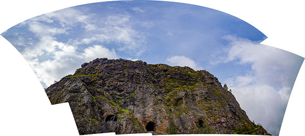
I tend to think of Mitchell Point adits as skylight doors overlooking the Columbia River and Washington state.
Mitchell Point is part of the great flow from the Grande Rounde Basalt, which erupted some 16 million years ago. Above (about 1200 ft) Mitchell Point proper is part of the Saddle Mountain Basalt which erupted some 12 million years ago. And in between these two basalt groupings are gravel deposits from the ancient Columbia River. Which means these photographic views of the Point and Mountain were very, very below the river bed of that ancient Columbia River flowing 1200 feet above today's camera lens.
Photographically, there is some distortion in the top image with left adit number 4 appearing higher than the middle #3 adit and the western right hand adit #2. This has to do with stitching 9 images together from a wider angle 28mm camera lens. I will re-photograph and actually put the top back on to Mitchell Mountain soon! It just wouldn't fit.
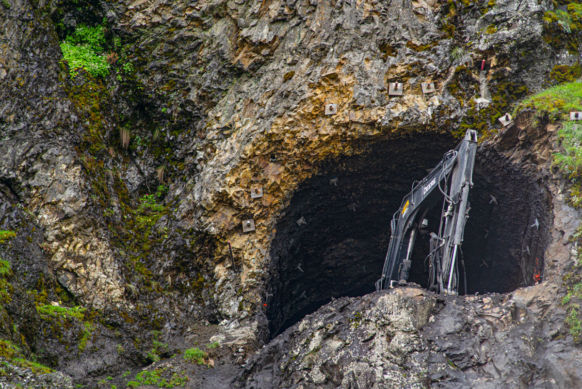
Above is Adit #4 (most eastern). Note Rock bolts around the perimeter and inside the tunnel.
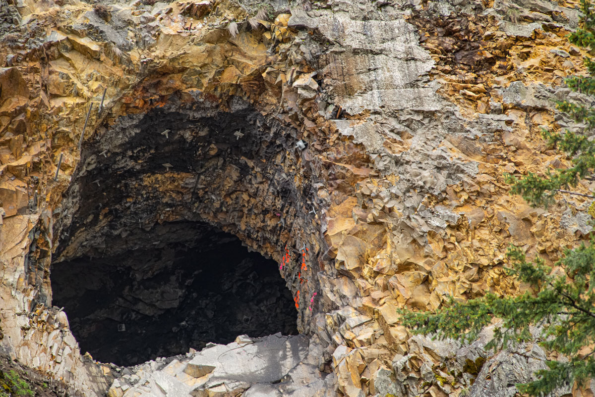
MIddle Adit #3, also with rock bolts but awaiting the nuts (?tech term).
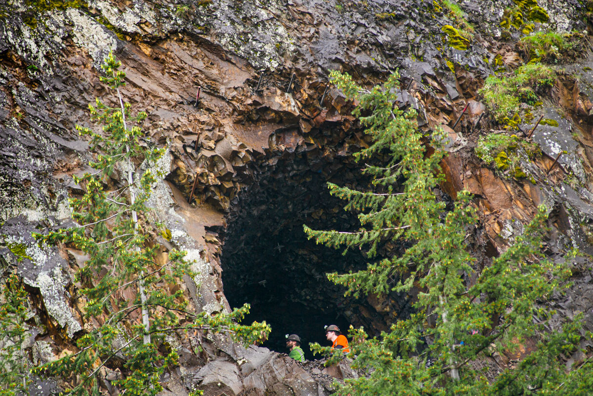
Adit #2 awaiting rock nuts as well and workers in the western most visible adit. Wondering if these trees will be in our incredible view as we cycle by this window in 2023.

72km.org
Travel
Our trips traveling by bicycle. Our trips in Central America, Europe and Across the USA.
Always following the Rule:
A mile at the beginning of the day is not as long as the mile
at the end of the day.
Voices & Words
Articles published, articles written, histories of the families, and of course food seen and enjoyed